About FATMAP - 3D Outdoor Maps & Resort Guides - Skiing, Hiking and Mountain Biking
Understand the terrain and know any area like a local on day one with outdoor adventure maps from FATMAP. Now introducing both winter and all new summer* maps! (*All summer maps are in beta) FATMAP is the ultimate tool...
Understand the terrain and know any area like a local on day one with outdoor adventure maps from FATMAP. Now introducing both winter and all new summer* maps! (*All summer maps are in beta) FATMAP is the ultimate tool kit for skiing, hiking and mountain biking adventures, bringing together expert content and mapping tools all in one app. [NOTE] - Minimum requirements: iOS 7 or later; iPad 4, iPad mini 2, iPhone 5 and above. This app is NOT supported on earlier generations. ** For technical support, contact:
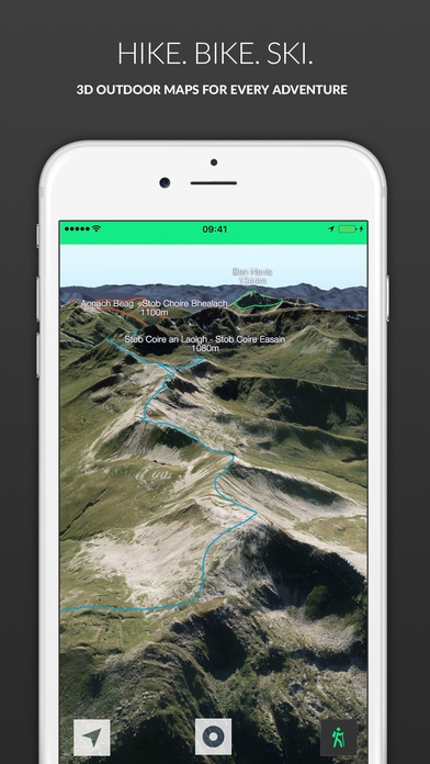
[email protected] -------------------------- *REVIEWS* An app that will revolutionise your backcountry freeriding experience - Red Bull There has never been a more all-encompassing ski map application - Financial Times "The level of detail is just amazing both visually and in terms of weather / lift / facilities info. Mountains that look like mountains, not Google Earth approximation - which is all we've had until now.!" - Atari Falcon "This blows other ski apps out of the powder. The next-generation of ski map" - Chris Banks "This is very cool. I have the free map of verbier (which I know well) and I am amazed by its accuracy - all the bumps are in the right place. This is definitely the future and quite amazing." - J.J. "Simply amazing and worth every EURO!" - Mr Freeride -------------------------- *OVERVIEW* Enjoy highly accurate GPS-enabled ski navigation to locate yourself with ease and experience virtual reality 3D fly-throughs of piste and classic off-piste lines. See every ski line mapped, detailed and rated in ultra high-resolution 3D. Freeriders can tap into our essential terrain intelligence menu to assess risk zones and slope gradients, for a safer day off-piste. Share your stats with built-in ski tracking, access interactive resort information and download any map offline. Choose between FREE and PREMIUM two-week or one-year subscriptions. -------------------------- *FEATURES* FATMAP Free Features: - Ultra High-Resolution 3D Mapping - Virtual 3D Fly-Throughs - Piste, Off-piste, Hike, Ride Mapping & Profiling - Interactive Adventure Information - Tracking & Stats FATMAP Premium Features: - Ultra high resolution satellite imagery - Advanced Mapping & Profiling - Avalanche Risk Zones - Gradient Heat Mapping - Crevasse Zones - Altitude Segmentation - Aspect Indicators -------------------------- **NEW SUMMER MAPS** New maps available: - England - Lake District - Scotland - Ben Nevis - Wales - Brecon Beacons More coming soon: - Scotland - Glen Coe - Switzerland - Verbier - Switzerland - Zermatt - Switzerland - Lenzerheide - Wales - Snowdonia - Andora - Vallnord - Canada Whistler - France - Chamonix - France - Morzine & Les Gets - Scotland - Torridon - Scotland - Cuillins - Scotland - Cairngorm See the complete list of areas launching in 2016 at: http://fatmap.com/ski-resort-maps/ -------------------------- We believe that uncertainty stops us from pushing our limits and finding out who we truly are. FATMAP empowers skiers, hikers and mountain bikers with the knowledge and tools to explore further, safely. We ve worked with pro skiers, Mountain Guides, Mountain Rescue Associations and skiers and snowboarders everywhere to create FATMAP Ski. Note: FATMAP uses GPS to record tracks. When these features are activated, FATMAP will continue to use GPS even when the app is in the background. Continued use of GPS running in the background can dramatically decrease battery life.
Requires iOS 7.0 or later. Compatible with iPhone, iPad, and iPod touch.
Previous Versions
Here you can find the changelog of FATMAP - 3D Outdoor Maps & Resort Guides - Skiing, Hiking and Mountain Biking since it was posted on our website on 2016-10-03 15:01:59.
The latest version is 1.5.1 and it was updated on 2024-04-23 08:55:58. See below the changes in each version.
FATMAP - 3D Outdoor Maps & Resort Guides - Skiing, Hiking and Mountain Biking version 1.5.1
Updated At: 2015-02-01
Disclaimer
Official App Store Link
We do not host FATMAP - 3D Outdoor Maps & Resort Guides - Skiing, Hiking and Mountain Biking on our servers. We did not scan it for viruses, adware, spyware or other type of malware. This app is hosted by Apple and passed their terms and conditions to be listed there. We recommend caution when installing it.
The App Store link for FATMAP - 3D Outdoor Maps & Resort Guides - Skiing, Hiking and Mountain Biking is provided to you by apps112.com without any warranties, representations or guarantees of any kind, so access it at your own risk.
If you have questions regarding this particular app contact the publisher directly. For questions about the functionalities of apps112.com contact us.